|
||||||||||||||||||||||||||||||||||||||
|
Home
> Palaeoclimatic maps: palaeoprecipitations
Palaeoclimatic maps: palaeoprecipitations
Effective precipitation is a key factor determining the rate of production and transport of sediments and an important input to our TOPOSED model. Therefore, we aim to quantify the paleoprecipitation and of the runoff on the Africa for the same time slices than the paleogeographical maps (Figure 5). These paleoprecipitation maps will be based on geological data such as:
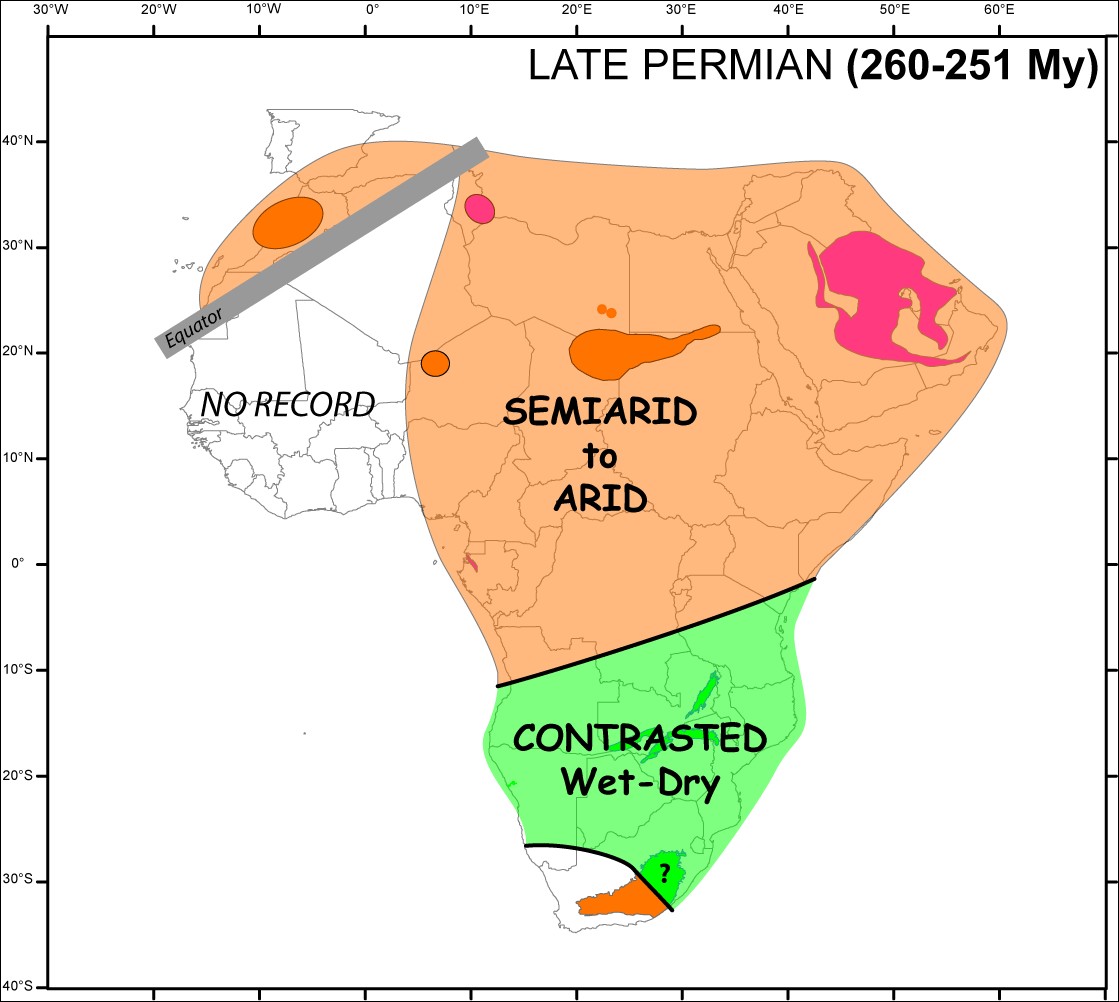
Example of palaeoclimatic maps focussed on the palaeoprecipitations: Africa during the Late Permian.
|
||||||||||||||||||||||||||||||||||||||